
A Data Structures & Algorithms project that simulates real-world navigation systems using Graph Algorithms such as Dijkstra, A*, BFS, and DFS to compute optimal routes based on distance, travel time, toll cost, and dynamic traffic conditions.




Modern transportation systems require efficient route optimization to minimize travel time, distance, fuel consumption, and operational costs.
Without intelligent route planning:
- Routes may be longer than necessary
- Travel costs increase
- Traffic congestion causes delays
- Delivery efficiency decreases
- Navigation systems become less reliable
The Intelligent Route Planner solves this problem by modeling a city as a weighted graph and applying advanced graph algorithms to determine optimal routes between locations.
The project represents:
- Locations as Nodes
- Roads as Edges
- Distance / Time / Cost as Edge Weights
Users can select a source and destination, and the system computes the most efficient route using different graph algorithms.
Workflow:
Location Selection ↓ Graph Construction ↓ Adjacency List Creation ↓ Route Optimization Algorithm ↓ Shortest Path Calculation ↓ Route Summary & Visualization
Intelligent-Route-Planner/
├── main.py              ← Entry point
├── requirements.txt
├── .gitignore
├── README.md
│
├── src/
│   ├── data_builder.py  ← Generates city graph CSV
│   ├── graph_loader.py  ← Loads graph + cost functions
│   ├── router.py        ← BFS, DFS, Dijkstra, A*
│   ├── dynamics.py      ← Traffic & road closure
│   ├── visualizer.py    ← Matplotlib route rendering
│   └── app.py           ← Flask API + dashboard server
│
├── static/
│   └── index.html       ← Web dashboard UI
│
├── data/                ← Auto-generated CSVs
└── outputs/             ← Generated route images
| Feature | Description |
|---|---|
| Graph-Based Road Network | Locations modeled as nodes and roads as edges |
| Dijkstra Algorithm | Computes optimal shortest path |
| A* Search Algorithm | Faster heuristic-based routing |
| BFS Traversal | Fewest-hop route exploration |
| DFS Traversal | Deep graph exploration |
| Adjacency List | Memory-efficient graph representation |
| Priority Queue (Min Heap) | Optimized shortest-path processing |
| Dynamic Traffic Simulation | Adjust edge costs in real time |
| Road Closures | Simulate blocked roads |
| Multi-Criteria Routing | Time, Distance, Toll & Eco Modes |
| Route Visualization | Graphical route rendering |
| Route Summary Report | Distance, ETA, Cost Analysis |
| Interactive Dashboard | Web-based route planner |
| Concept | Purpose |
|---|---|
| Graphs | Road Network Representation |
| Directed Graph | One-Way Roads |
| Weighted Graph | Distance and Time Modeling |
| Adjacency List | Efficient Graph Storage |
| BFS | Breadth-First Traversal |
| DFS | Depth-First Traversal |
| Dijkstra's Algorithm | Shortest Path |
| A* Algorithm | Heuristic Route Optimization |
| Priority Queue | Efficient Node Selection |
| Path Reconstruction | Route Recovery |
| Multi-Criteria Optimization | Realistic Route Selection |


Used for finding the shortest path in weighted graphs with non-negative edge weights.
Time Complexity:
O((V + E) log V)
Enhances Dijkstra by using a heuristic (Haversine Distance) to guide the search.
Time Complexity:
O(E)
Average performance is significantly faster than Dijkstra for large road networks.
Finds routes with the fewest number of hops.
Time Complexity:
O(V + E)
Explores deep graph paths before backtracking.
Time Complexity:
O(V + E)
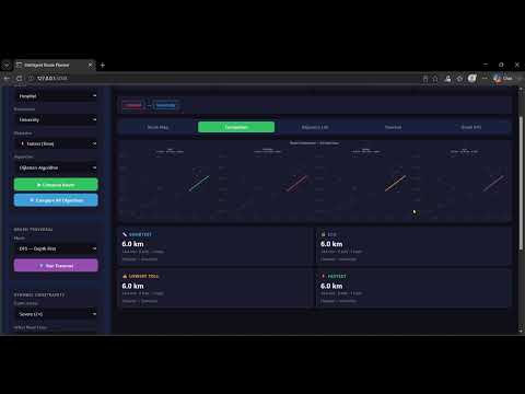
👉 Click the image above to watch the full demo
- Python
- Flask
- NetworkX
- Matplotlib
- Graphs
- Adjacency Lists
- Queues
- Stacks
- Priority Queues (Min Heap)
- BFS
- DFS
- Dijkstra
- A*
- Multi-Criteria Routing
| Method | Endpoint | Description |
|---|---|---|
| POST | /api/route | Compute Optimal Route |
| POST | /api/compare | Compare Route Objectives |
| POST | /api/traversal | BFS or DFS Traversal |
| GET | /api/adjacency | Graph Adjacency List |
| POST | /api/traffic | Apply Traffic Conditions |
| POST | /api/closure | Close Road |
| POST | /api/reset | Reset Network |
| GET | /api/graph_stats | Graph Statistics |
The synthetic city contains:
- 15+ Locations
- 30+ Road Connections
- Toll Roads
- One-Way Roads
- Residential Roads
- Highways
- Primary Roads
Sample Locations:
- Airport
- Railway Station
- Hospital
- University
- Shopping Mall
- Tech Park
- City Center
git clone https://github.com/Sonia068/Intelligent-Route-Planner.git

cd Intelligent-Route-Plannerpip install -r requirements.txtpython main.pyhttp://127.0.0.1:5000
- Google Maps Style Navigation
- Ride-Hailing Platforms
- Logistics & Delivery Optimization
- EV Route Planning
- Smart City Transportation
- Fleet Management Systems
- Emergency Response Routing
After completing this project, I gained practical experience in:
- Graph Data Structures
- Route Optimization Problems
- BFS and DFS Traversals
- Dijkstra Algorithm
- A* Search Algorithm
- Priority Queues and Heaps
- Adjacency List Representation
- Algorithm Complexity Analysis
- Backend Development with Flask
- Interactive Dashboard Design
- Real-World Transportation Systems
- OpenStreetMap Integration
- Real-Time Traffic Data
- EV Charging Station Routing
- Multi-Modal Transportation
- Live GPS Tracking
- Route Recommendation Engine
- Machine Learning Based ETA Prediction
Sonia Thakur
GitHub: https://github.com/Sonia068
👉 Click the image above to watch the full demo
⭐ If you found this project useful, please consider giving it a star on GitHub.