
This project is 3D Motion Planning for flying car that is developed in local machine and connecting with simulator.
Motion-Planning simulator for this project that's appropriate for your operating system from the simulator releases respository.
If you haven't already, set up your Python environment and get all the relevant packages installed using Anaconda following instructions in this repository
git clone git@github.com:mrahman53/fc-motion-planning.git
source activate fcnd python motion_planning.py
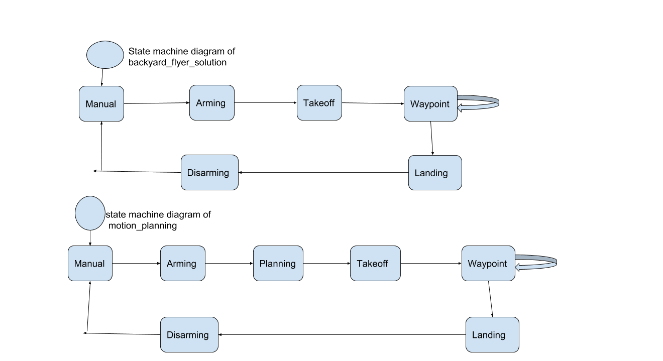
Code Starter: In backyard_flyer_solution.py and motion_planning.py provided by Udacity, there are some differences that is extra state has ben added which is planning state.
In planning_utils.py, create_grid, A* algorithm and prune_path method was given and A* has been modified later.
In motion_planning.py, where all the steps are implemented form Arming to flying to Landing. Besides the few supportive functions from planning_utils for path_planning.
Phases of backyard_flyer_solution.py: Manual--->Arming---->TakeOff---->Waypoint---->Disarming
Phases of motion_planning.py: Manual--->Arming---->Path-Planning----->TakeOff---->Waypoint---->Disarming
In plan_path method:
--the vehicle's route planning is implemented from current position to goal position.
--With given target_altitude and saftey_distance is set to 5.
--From the colliders.csv file we extracted the lat0 and lon0 which has been set vehicle's home position.
--Then Convert a global position (lon, lat, up) to a local position (north, east, down) relative to the home position using global_to_local function.
--After reading the obstacle map data from colliders.csv, we created grid.
--Then set some goal position from command line to route.
--Used A* algorithm with diagonal motion to optimize our route search.
--Used Collinearity technique to implement prune function that minimize Waypoints.
A* algorithm:
--Used Action Enum set to a cost of sqrt(2) for diagonal motion.
--Used valid_actions function to validate the next move.